
Field evidence, kept in view
Turn field evidence into a plan you control.
See fields, inputs, zones and rates together. Review the plan, then generate ISOXML or Shapefile for the next system.
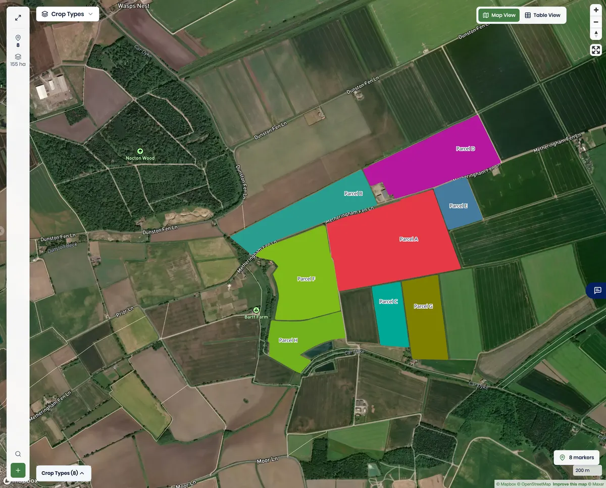
- 155.5 ha
- 8 fields · 8 crops
- Parcel A · 5 zones
Screens are unedited captures of the running product using demonstration data.
Follow the field from source to export.
Six product states keep the same field, its evidence and the human review boundary connected.
One field, one evidence trail
Choose a field
Start in the multi-field workspace and select the boundary to evaluate while the other fields stay in view.
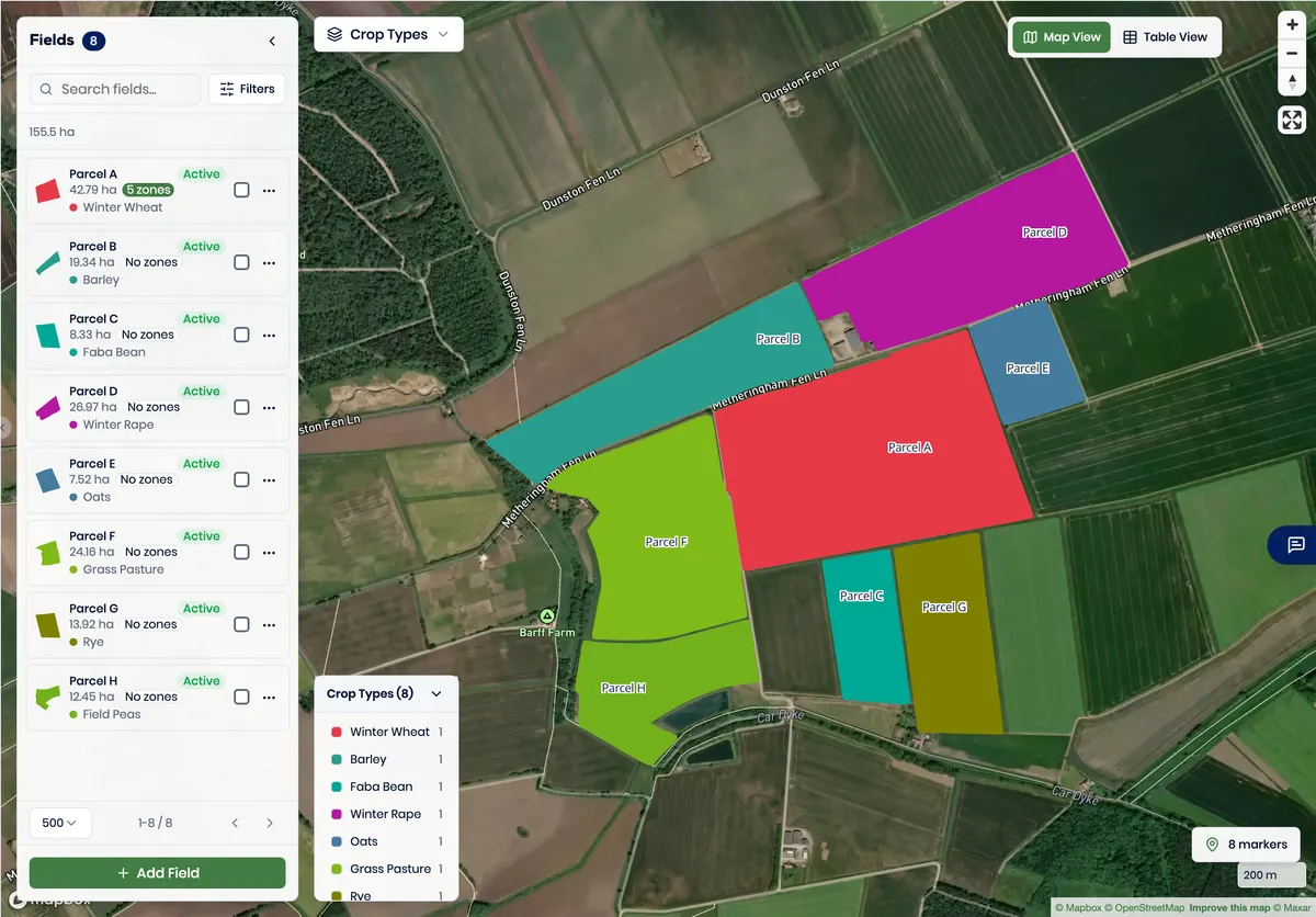
Inspect the inputs
Check the selected boundary, source records, units and analysis values.
- Zone classes follow the national soil classification your laboratory reports against. Latvian and German systems are supported today.
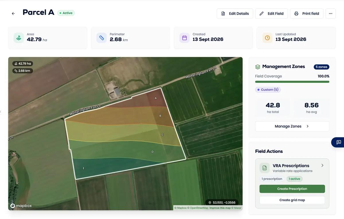
Review the zones
Compare the five management zones, their labels and their classes.
- Zone identity is communicated with text and boundaries as well as colour.
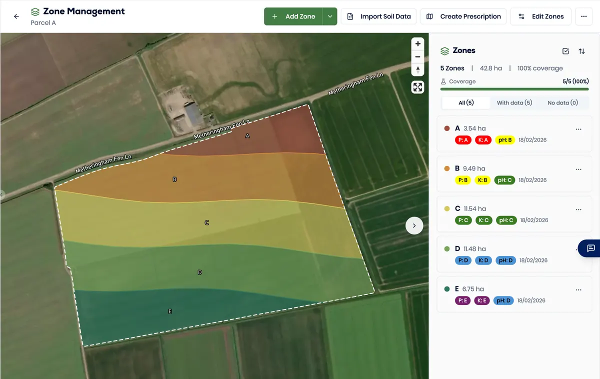
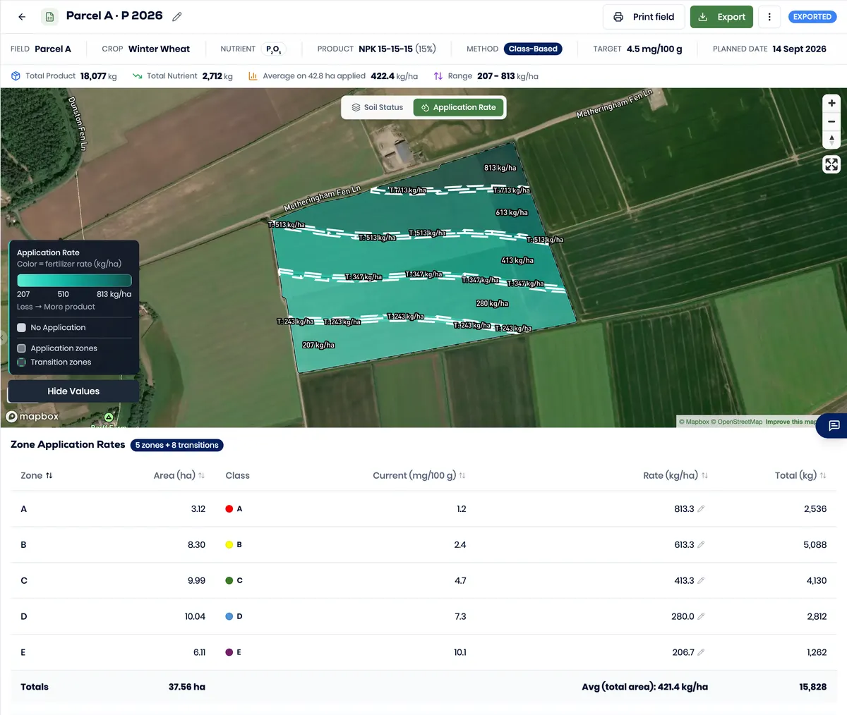
Inspect the rates
Read the calculated rate for each zone and check the visible variation.
- The rate for each zone follows its class and stays visible for review.
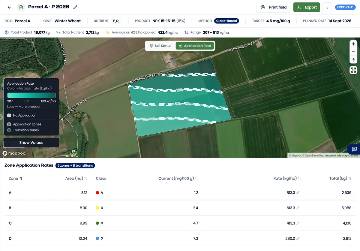
Keep human control
A responsible person reviews the inputs, zones and rates before export.
- Access rights and human review are separate. No formal approval workflow is claimed.
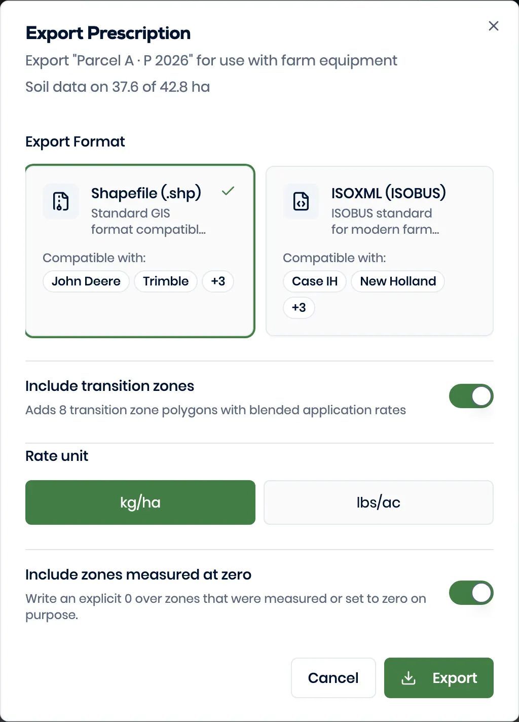
Generate the package
Create ISOXML or Shapefile from the reviewed plan.
- Both formats generate from the running product. Confirm terminal acceptance for your setup.
VRA to export
Move a reviewed plan into a real package.
The running product generated both output formats from the same reviewed plan.
ISOXML
Generate an ISOXML package led by TASKDATA.XML.
parcel-a-p-2026-isoxml.zipShapefile
Generate the related Shapefile components in one package.
parcel-a-p-2026-shapefile.zip
Choose your operating path
Start with the job you need to do.
The product stays consistent while the evaluation path reflects field, team or partner responsibilities.
Farms, independent agronomists and contractors
Review boundaries, zones and calculated rates before you create an output.
Talk about your workflowOperations and enterprise teams
Evaluate invitations, roles, field access and the export boundary.
See the platform in depthWhite-label partners
Scope a partner-branded environment, language needs and operating responsibilities.
Explore the white-label environmentSix practical questions, answered.
Contact usWhat data can I start with?
Start with a field boundary and the agronomic records relevant to your plan. Confirm the exact source files and units for your workflow.
Can I review zones and rates before export?
Yes. The workflow keeps the zones, classes and calculated rates visible for human review before export.
Which output formats are available?
The product generates both ISOXML and Shapefile packages. Confirm the exact terminal, implement, licence and configuration before field use.
Can several people work in one account?
Yes, within the demonstrated roles and access levels. Account roles, field or farm access and human review remain separate controls.
Can I use my government field boundaries?
Better Yield imports Shapefile, GeoJSON, KML and CSV. If your rural payments service lets you export your parcels, that file is what we read.
Which soil index systems do you support?
Better Yield reads the soil class your laboratory reports against. Latvian and German systems are supported today, and British index systems are in preparation.