
ISOXML
Generate an ISOXML package led by TASKDATA.XML.
Generated package
Verified local archiveparcel-a-p-2026-isoxml.zip1,153 B · SHA-256 9213ad5159da…
- TASKDATA/
TASKDATA.XMLtask definitionGRD00001.BINapplication grid
Field-to-export platform
Move from a multi-field workspace to inputs, zones, calculated rates, human review and an export package.
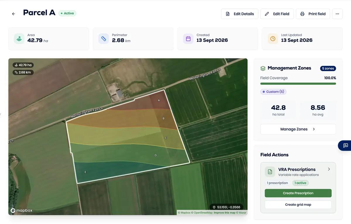
Screens are unedited captures of the running product using demonstration data.
Start with evidence
Bring the boundary and relevant agronomic records into one review path before calculating a variable-rate plan.
Field boundaries Select an irregular boundary from the multi-field workspace and check its map context.
Analysis values and units Review the source values and units used to classify each management zone.
Crop and product inputs Keep the crop, nutrient and product assumptions visible to the reviewer.
Five zones, visible rates
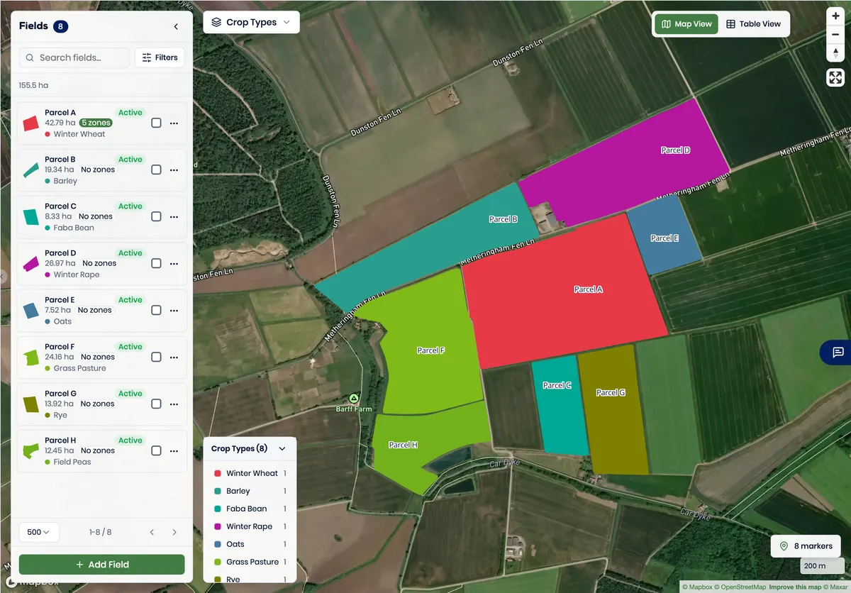
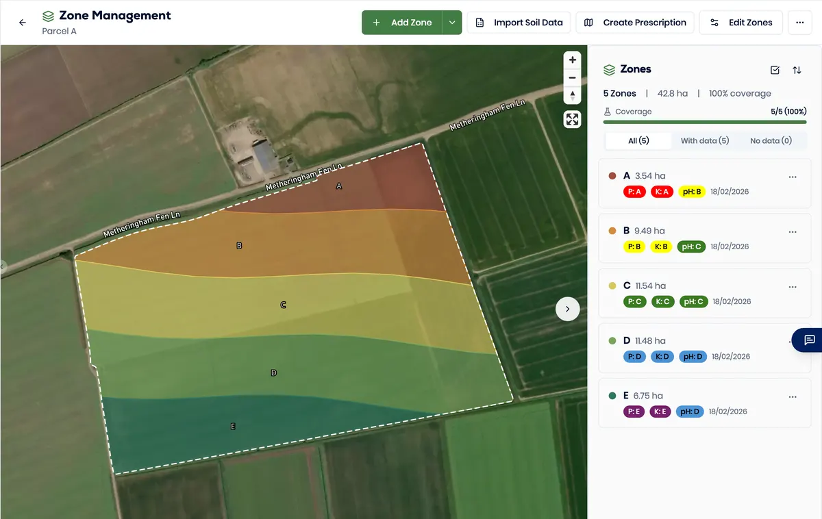
The same irregular field carries its classes and calculated rates through the genuine interface.
Geometry Check the field boundary and all five zone shapes against the map context.
Classification Compare the visible class and analysis values for each zone.
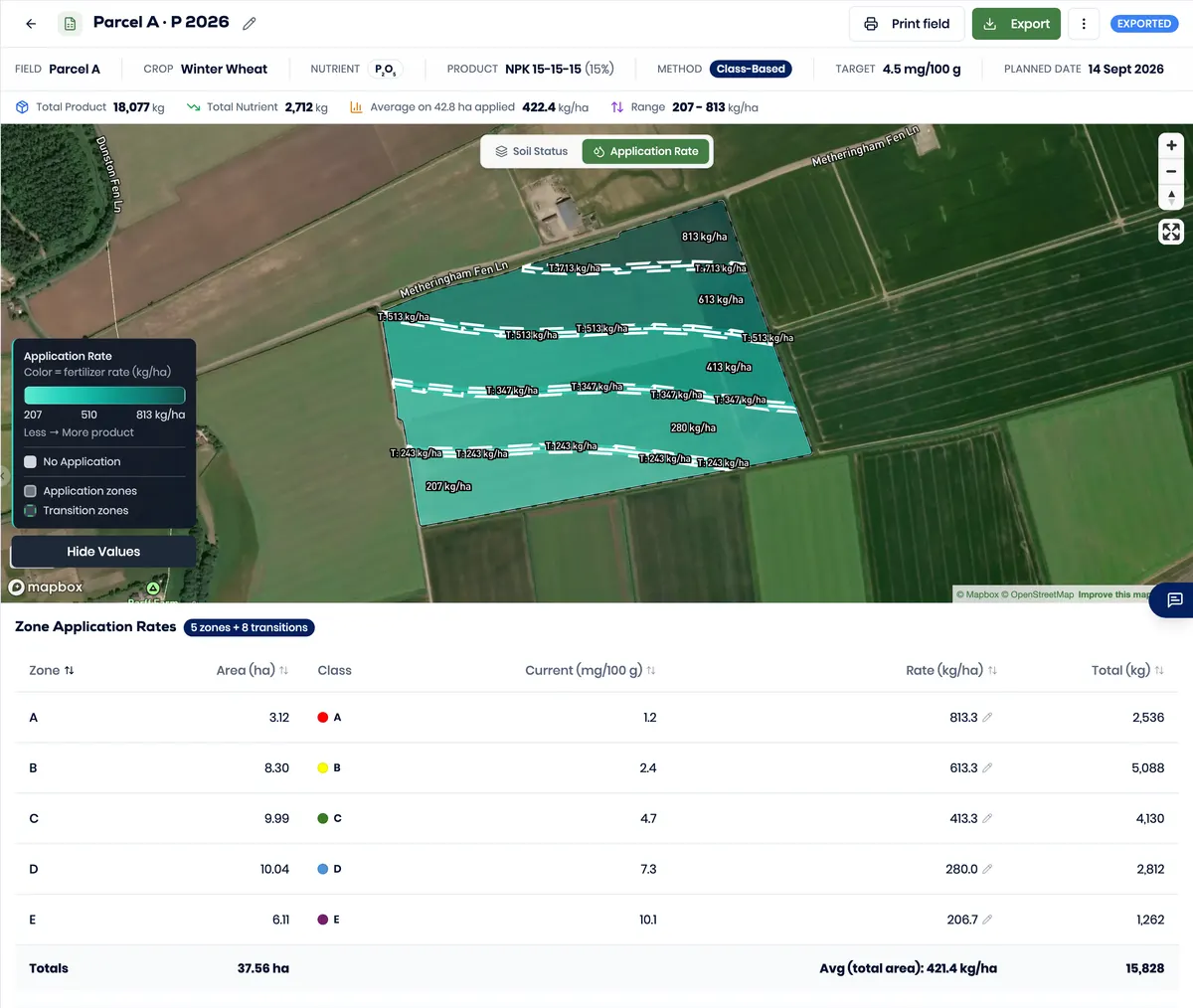
Calculated rates Inspect the labelled zone rates and visible variation before export.
Human decision A responsible person decides whether the reviewed plan is ready to export.
Prescription to package
ISOXML and Shapefile were generated from the same variable-rate plan in the running product.
ISOXML package Generated from the reviewed plan with TASKDATA.XML in the package.
Shapefile output Generated from the same plan with its related file components.
Compatibility check Confirm the target terminal, implement, licence and configuration before field use.
VRA to export
The running product generated both output formats from the same reviewed plan.
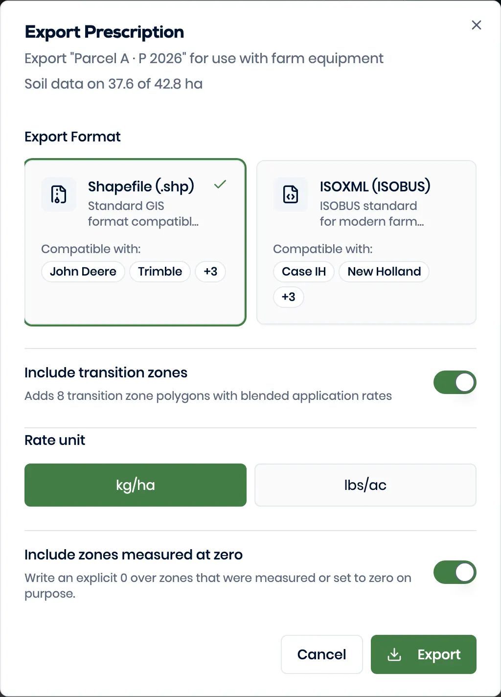
Choose the output needed by the next system
Generate an ISOXML package led by TASKDATA.XML.
Generated package
Verified local archiveparcel-a-p-2026-isoxml.zip1,153 B · SHA-256 9213ad5159da…
TASKDATA.XMLtask definitionGRD00001.BINapplication gridGenerate the related Shapefile components in one package.
Generated package
Verified local archiveparcel-a-p-2026-shapefile.zip6,276 B · SHA-256 858e51ead313…
parcel-a-p-2026.shpgeometryparcel-a-p-2026.shxshape indexparcel-a-p-2026.dbfrate attributesparcel-a-p-2026.prjcoordinate systemparcel-a-p-2026.cpgUTF-8 declarationA generated package does not prove compatibility with every terminal, implement, licence or configuration. Confirm the intended combination.
Invitations and access
The product separates account roles from field and farm access. Human review remains a distinct responsibility.
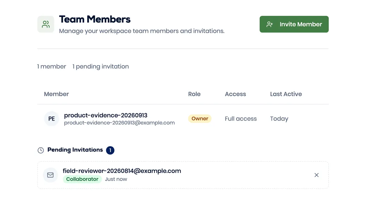
Every workspace has one owner, administrators who share the owner’s reach over the data, and collaborators who see only the fields they are given.
| Can | Owner | Administrator | Collaborator |
|---|---|---|---|
| Fields and farms | Create, edit, delete | Create, edit, delete | Work on assigned ones |
| Zones, soil and rates | Every field | Every field | Assigned fields, by level |
| People | Invite, assign, remove | Invite, assign, remove | No |
| The workspace itself | Transfer or close it | No | No |
A collaborator is set to Viewer, Operator, Editor or Manager, on named fields or on a whole farm — and a farm grant carries every field in it.
The genuine interface keeps them visible across the field, zone and rate views, and the responsible person reviews them before export.
Do not treat the workflow as complete. Keep the source file and visible state, then bring the exact file and target system to a product evaluation.
The product uses owner, admin and collaborator account roles plus viewer, operator, editor and manager field or farm access.
No. Generating a package is not the same as a terminal accepting it. Confirm the specific terminal, implement, licence and configuration before field use.